The Art of Reading the Land
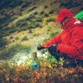
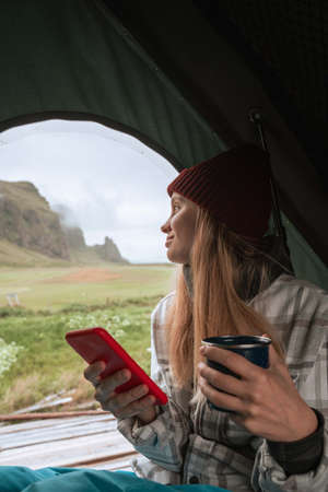
When it comes to camping in America’s vast and diverse wilderness, mastering the art of reading terrain features is an essential skill. Whether you’re pitching a tent beneath towering pines in the Pacific Northwest or trekking across the rolling hills of the Midwest, understanding the lay of the land can transform your outdoor experience. It’s more than just knowing north from south—it’s about interpreting subtle clues in the environment that reveal hidden streams, ideal campsites, or potential hazards. For American campers, terrain awareness is not only a matter of safety but also a way to deepen your connection with nature. The ability to “read” the landscape enhances your sense of adventure, encourages responsible exploration, and ensures every journey into the wild is both memorable and mindful.
Essential Terrain Features to Know
Understanding the lay of the land is an essential skill for every American camper. The great outdoors across the United States offers a variety of natural landforms, each with unique characteristics that can influence your camping experience and safety. From the rolling ridges of the Appalachians to vast Midwestern valleys and winding creeks in national parks, knowing how to identify and interpret these terrain features elevates your outdoor adventures. Let’s explore some of the most common landforms you’ll encounter on your camping journeys—and why they matter.
| Terrain Feature | Description | Why It Matters for Campers |
|---|---|---|
| Ridges | Long, narrow elevations of land, often forming high points or dividing lines between valleys. | Offer panoramic views, potential wind exposure, and are useful landmarks for navigation. |
| Valleys | Low-lying areas between hills or mountains, usually with a stream or river running through. | May provide shelter from wind but could be prone to cold air pooling and morning fog. |
| Creeks & Streams | Narrow bodies of running water found throughout forests and meadows. | Source of fresh water, good for campsite proximity but beware of flooding risks during storms. |
| Clearings | Open spaces within forests where sunlight reaches the ground. | Ideal for pitching tents, gathering around campfires, and spotting wildlife, but less natural cover from weather. |
| Saddles | The low point between two higher elevations on a ridge or mountain range. | Natural travel corridors; often used as trail crossings and pathways for both people and animals. |
| Bluffs & Cliffs | Steep faces of rock or earth rising sharply above surrounding terrain. | Spectacular viewpoints but require caution—stay back from unstable edges! |
Navigating with Nature’s Landmarks
Tuning into these features not only keeps you oriented but also helps you make smarter decisions about where to set up camp, how to stay safe from changing weather conditions, and where to find resources like water or firewood. Whether you’re hiking through dense Pacific Northwest forests or setting up camp along a Southwestern arroyo, knowing your ridges from your valleys ensures you’re always one step ahead in the wild. Next time you’re out under big American skies, let the land itself guide your adventure—just like seasoned campers have done for generations.

3. Practical Tips for Reading Terrain on Trail
When you’re out exploring America’s vast outdoors, reading the land is more than just a cool skill—it’s your ticket to safe and confident adventures. Here are some hands-on techniques every camper should master to interpret terrain features on the trail:
Look for Physical Landmarks
Start by training your eyes to spot natural markers like ridges, valleys, streams, and tree lines. Hills and saddles often guide the way, while river bends or rock formations can serve as crucial reference points. The more you notice these details, the better you’ll be at orienting yourself and predicting what lies ahead.
Pair Map Reading with Real-World Cues
Traditional map reading is even more powerful when paired with on-the-ground observation. Learn to match contour lines, elevation marks, and symbols from your topographic map with the actual sights around you. Hold your map so it matches the direction you’re facing—this simple move helps sync your mental compass with reality.
Practice Estimating Distance and Scale
Distances in the wild can be deceiving. Practice gauging how far a landmark appears versus its actual distance on your map. Use pacing or familiar objects (like a football field) as rough measuring tools until your estimates become second nature.
Notice Vegetation Patterns
The types of plants and trees growing around you can offer subtle terrain clues. For example, lush greenery may indicate lower ground or water sources, while sparse vegetation often marks higher elevations or rocky outcrops. Observing these patterns adds another layer to your terrain-reading toolkit.
Stay Mindful and Adjust as You Go
The landscape can shift quickly—especially in America’s diverse wilderness areas. Stay alert to changing slopes, unexpected obstacles, or shifting weather conditions that might alter your route. Adapting your approach based on what you see is key to both safety and enjoyment on the trail.
By combining these practical skills with a sense of curiosity and respect for the land, every American camper can turn terrain reading into a trusted part of their outdoor experience.
4. How Terrain Impacts Safety and Comfort
Choosing the right campsite goes beyond just finding a scenic spot—it’s about understanding the landscape to ensure both safety and comfort. American campers know that terrain features like slopes, drainage, and natural cover can make all the difference between a restful night under the stars and a stressful one spent dodging hazards. Let’s break down how reading these features can set you up for a great camping experience.
Slopes: Not Too Steep, Not Too Flat
Pitching your tent on a slope might seem adventurous, but it comes with risks. A gentle incline helps with water runoff during rain, but too much slope can have you sliding in your sleep. Flat ground is comfortable for sleeping, but if it’s in a depression, you could wake up in a puddle. The key is finding balance:
| Terrain Type | Pros | Cons |
|---|---|---|
| Gentle Slope | Good drainage, reduces pooling water | If too steep, uncomfortable to sleep |
| Flat Ground | Comfortable for tents and gear setup | Risk of water accumulation during rain |
| Steep Slope | Rarely chosen unless necessary for safety from flooding | Difficult sleeping, increased risk of slips and falls |
Drainage: Stay High and Dry
Poor drainage is one of the biggest threats to camper comfort. Low-lying areas or gullies may look inviting, but they often become streams during heavy rain. Before setting up camp, check for signs of previous water flow—like bare patches or washed-out soil. Choose spots elevated above obvious drainage channels to stay dry and avoid muddy surprises.
Natural Cover: Protection from Elements
Trees and shrubs offer more than just beauty—they’re natural allies against wind and sun exposure. However, be mindful of overhead hazards such as dead branches (widowmakers) that could fall during a storm. A well-chosen cover provides shade on hot days and shields you from gusts, making your outdoor experience much more pleasant.
Quick Checklist for Safe and Comfortable Campsite Selection:
- Avoid depressions or obvious runoff channels.
- Select gentle slopes for drainage but avoid steep inclines.
- Look for sturdy natural windbreaks like bushes or boulders.
- Check above for dead branches before pitching your tent.
- Stay clear of animal trails and insect-prone areas.
Mastering terrain reading isn’t just about following best practices—it’s about blending local wisdom with an eye for detail, ensuring every American camping adventure is as safe as it is memorable.
5. Bringing It All Together: Real-Life Scenarios
Now that youve explored the basics of reading terrain, its time to see how these skills play out in real-life adventures. Imagine youre hiking through the dramatic peaks of the Rockies—here, recognizing a sudden change in tree species or soil dampness can help you spot hidden mountain springs or avoid unstable scree slopes. Out east in the rolling Appalachians, knowing how to interpret ridgelines versus hollows can mean finding the perfect campsite sheltered from chilly winds or afternoon thunderstorms.
Let’s put your new knowledge to the test. Picture yourself setting up camp near Shenandoah National Park; by identifying south-facing slopes, you catch the last golden rays of sun and stay warmer at night. Or perhaps you’re backpacking in Yellowstone: spotting where animal tracks converge on a game trail not only boosts your wildlife sightings but also helps you steer clear of potential bear hotspots. In desert landscapes like Joshua Tree, understanding washes and arroyos warns you away from flash flood zones and guides you toward elusive water sources.
Every American landscape—from vast prairies to dense Pacific Northwest forests—offers unique terrain features waiting to be read. Practice observing subtle changes: a shift in vegetation might indicate a nearby waterway, while a sudden drop in elevation could mean an approaching ravine. With each outing, sharpen your ability to “read” the land, so your camping experience is safer, smarter, and filled with discovery.
6. Resources for Sharpening Your Skills
If you’re ready to take your terrain-reading abilities to the next level, America offers a wealth of resources designed just for outdoor enthusiasts. Whether you’re a seasoned camper or brand new to the trails, these tools and programs can help you feel more at home in the wild.
Essential Guidebooks
No American camper’s library is complete without classic field guides like “The Complete Walker” by Colin Fletcher or “Be Expert with Map & Compass” by Björn Kjellström. These books go beyond basics, offering practical advice and detailed illustrations that bring topography and natural features to life. For region-specific tips, check out guides published by the National Park Service or local outdoor outfitters, which often include custom maps tailored to unique American landscapes.
Top-Rated Apps
Embrace modern tech with apps like Gaia GPS, AllTrails, or Topo Maps+. These digital tools offer real-time navigation, detailed topographic overlays, and the ability to download offline maps—making them invaluable companions on any American camping adventure. Many also feature user reviews and trail notes from fellow campers, giving you insider perspectives on tricky terrain features before you even lace up your boots.
Local Outdoor Programs
Hands-on learning is key to mastering terrain reading. Across the U.S., organizations such as REI Co-op host workshops and guided hikes focused on map reading and navigation skills. Many state parks and community centers also offer free or low-cost classes where you can practice identifying ridges, valleys, and water sources in real time. Don’t overlook local hiking clubs—they’re a great way to connect with experienced campers who love sharing their knowledge of America’s diverse backcountry.
Online Communities & Forums
Sites like Backpacker.com forums or Reddit’s r/Camping are treasure troves for peer advice. Here, campers swap stories about navigating the Rockies’ wild switchbacks or deciphering the rolling dunes of Great Sand Dunes National Park. By tapping into these communities, you’ll gain not only practical tips but also encouragement from folks who share your spirit of adventure.
Keep Exploring
The beauty of terrain reading is that there’s always something new to discover—whether it’s a hidden creek in your favorite forest or an unexpected vista along a familiar trail. With the right resources at your fingertips, every American camper can explore with greater confidence, safety, and wonder. So grab a guidebook, download an app, join a local workshop, and let the landscape be your ultimate teacher.