1. Staying Calm and Assessing Your Situation
Realizing you’re lost in the wilderness can be a scary moment, but your first priority is to stay calm. Panicking will only cloud your judgment and lead to poor decisions. Take a deep breath and give yourself a moment to clear your mind. Mental clarity is key to survival.
Take a Pause: The STOP Method
One helpful way to get your bearings is to use the STOP method:
| Letter | Meaning |
|---|---|
| S | Stop moving. Sit down if needed and avoid rushing into action. |
| T | Think about when and where you last knew your exact location. |
| O | Observe your surroundings—landmarks, weather, time of day, and terrain. |
| P | Plan your next steps based on what you know and what resources you have. |
Evaluate Your Surroundings
Look around for anything familiar: trails, footprints, rivers, or natural markers like mountains or unique trees. Try to recall how long it’s been since you last saw a known point or trail marker. Use the position of the sun to help orient yourself if you don’t have a compass.
Key Things to Observe:
- Natural landmarks (ridges, streams, peaks)
- The direction of the sun (morning = east, afternoon = west)
- Weather changes that may affect visibility or travel
- Your physical condition—are you tired, hungry, injured?
Take Stock of Your Resources
You’ll also need to check what gear and supplies you have on hand. Knowing what you’re working with will help you make better choices about how to proceed.
| Resource Type | Examples |
|---|---|
| Navigation Tools | Map, compass, GPS device, phone with offline maps |
| Shelter & Warmth | Tent, tarp, space blanket, extra layers of clothing |
| Food & Water | Energy bars, trail mix, water bottles, purification tablets or filter |
| Signaling Devices | Whistle, mirror, flashlight with strobe function |
| First Aid Supplies | Bandages, antiseptic wipes, pain relievers, tweezers |
A Quick Tip:
If you have cell service—even one bar—send a text message with your last known location instead of calling. Texts often go through when calls don’t in weak signal areas.
The goal at this stage isn’t to rush into action—it’s to calmly understand where you are and what options are available. A clear head and thoughtful approach can make all the difference in an emergency navigation situation.
2. Using Natural Landmarks and the Environment
When youre lost in the wilderness without a map or compass, nature itself can be your guide. Learning how to read the landscape can help you figure out which direction youre facing and how to get back on track. Lets break down some of the most reliable natural indicators you can use.
Mountains, Hills, and Ridges
If youre in an area with visible elevation changes like mountains or ridges, these can serve as fixed reference points. If you remember passing a certain mountain or ridge on your way in, use it to reorient yourself. High ground also gives you a better view of your surroundings, making it easier to spot trails, rivers, or clearings.
Rivers and Streams
Waterways are incredibly useful for navigation. In many parts of the U.S., rivers tend to flow toward larger bodies of water or downhill toward valleys and towns. Following a stream downstream may eventually lead you to civilization or at least a road or trail.
Quick Tip:
| Water Flow Direction | Possible Outcome |
|---|---|
| Downstream | Leads to lower elevations, possibly roads or populated areas |
| Upstream | Might lead to remote sources like springs or highlands |
The Sun’s Position
The sun rises in the east and sets in the west—this basic fact can be extremely helpful. In the morning, face the rising sun and youre roughly facing east. Around noon, in most parts of the U.S., the sun is generally toward the south if youre in the Northern Hemisphere. As the sun sets, its in the west. Use this knowledge along with shadows to estimate cardinal directions.
Using Shadows to Find Direction (Stick Method)
- Place a stick upright into level ground.
- Mark where the tip of its shadow falls (Point A).
- Wait about 15–30 minutes.
- Mark where the tip of the shadow now falls (Point B).
- A line drawn from Point A to Point B runs approximately west to east (A is west, B is east).
Trees and Moss
You mightve heard that moss grows on the north side of trees. While this can sometimes be true in shady forests, its not reliable everywhere. A better strategy is to look at tree growth patterns—branches often grow more heavily on the southern side due to more sunlight exposure in North America.
Caution:
Always use multiple environmental cues rather than relying on just one method. Nature isn’t always consistent, especially in different climates or seasons.
By learning how to interpret what nature shows you—whether its through mountains, waterways, or sunlight—you’ll have a much better chance of finding your way when you’re lost in unfamiliar terrain.
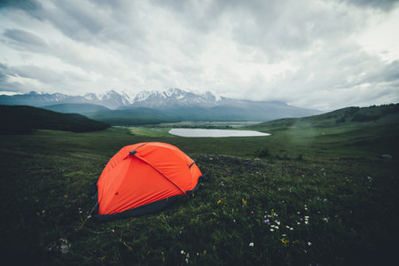
![]()
3. Improvised Navigation Techniques
When youre lost in the wilderness without a map or compass, knowing a few improvised navigation techniques can make all the difference. These field-tested methods use everyday items and natural elements to help you figure out direction and stay oriented. Let’s break down some simple ways to find your bearings using your watch, shadows, and stars.
Using an Analog Watch to Find North
If you have an analog (non-digital) watch, you can use it as a makeshift compass. This trick works best when the sun is visible.
Steps for the Northern Hemisphere:
- Hold your watch flat and point the hour hand toward the sun.
- Find the midpoint between the hour hand and 12 o’clock — this midpoint indicates south. The opposite direction is north.
This method may not be precise but gives a decent sense of direction during daylight hours.
Shadow Stick Method
This method uses the movement of the sun to determine east and west.
- Place a stick vertically into the ground.
- Mark the tip of the shadow with a small rock or twig — this marks west.
- Wait 15–30 minutes and mark the new position of the shadows tip — this is east.
- Draw a line between the two points: west to east. Stand with west on your left and east on your right; youll be facing north.
Finding Direction Using Stars
If youre navigating at night, stars can be your guide—especially in areas far from city lights.
Northern Hemisphere: Find Polaris (North Star)
- Look for the Big Dipper constellation.
- The two stars at the end of its “bowl” form a line that points directly to Polaris.
- Polaris is located almost directly above true north.
Southern Hemisphere: Use the Southern Cross
- Find the Southern Cross constellation and draw an imaginary line through its long axis (top to bottom).
- Extend that line about four and a half times its length down toward the horizon — that’s roughly south.
Quick Reference Table
| Method | Tools Needed | Best Used During | Direction Found |
|---|---|---|---|
| Watch Method | Analog Watch & Sunlight | Daytime | North/South |
| Shadow Stick | A Stick & Sunlight | Daytime | East/West/North/South |
| Star Navigation (Polaris) | Clear Night Sky | Nighttime (Northern Hemisphere) | North |
| Star Navigation (Southern Cross) | Clear Night Sky | Nighttime (Southern Hemisphere) | South |
No matter where you are, these practical skills can help you get back on track when technology fails or isn’t available. Practice them before heading out so youre ready when it counts.
4. When to Stay Put vs. When to Move
Getting lost in the wilderness can be scary, but knowing whether to stay where you are or start moving can make all the difference. Each choice has its pros and cons, and the right decision depends on your situation, resources, and environment.
Staying Put: The Safe Bet in Many Cases
If you’re truly lost and no one knows you’re missing yet, staying put is often the safest option. It makes it easier for search and rescue teams to find you because you’re not moving around and changing locations.
Pros of Staying Put
- Easier for rescuers to locate you
- Conserves energy and body heat
- You can set up a visible signal (like a fire or brightly colored gear)
- Reduces risk of injury from unfamiliar terrain
Cons of Staying Put
- If no one knows youre missing, help might not come soon
- Lack of nearby resources like water or shelter
- You may feel helpless or anxious without taking action
When Moving Might Be Necessary
If you’re confident about the direction back to safety—or if staying put puts you at greater risk—it may be smarter to move. This could mean heading downhill toward a stream or road, or following a known trail.
Pros of Moving
- Potentially gets you closer to help or safety
- You might find water, shelter, or cell service
- Can give a sense of control and purpose
Cons of Moving
- Risk of getting more lost if youre unsure of your direction
- Uses more energy and increases chance of injury
- Makes it harder for rescuers to track you down
How to Decide: Key Factors to Consider
The choice between staying or moving should be based on your current situation. Here’s a simple guide:
| Factor | Stay Put If… | Consider Moving If… |
|---|---|---|
| Your Location is Known | You told someone where you were going and when youd return. | No one knows your plans or location. |
| Shelter & Supplies Available | You have food, water, warmth, and can wait safely. | You lack essentials and conditions are worsening. |
| Weather Conditions | Poor visibility or bad weather—staying is safer. | The weather is clear enough to navigate safely. |
| Your Physical Condition | You’re injured or exhausted. | You’re healthy and able to travel carefully. |
| Navigation Confidence | You’re unsure which way leads back. | You recognize landmarks or know a safe route out. |
Pro Tip:
If you decide to move, leave signs behind—arrows made with sticks, messages drawn in dirt, or notes if possible. This helps rescuers track your path in case they arrive after youve moved on.
The key is staying calm, assessing your surroundings honestly, and making a plan based on facts—not fear. Your survival may depend on making the right call at the right time.
5. Signaling for Help
When youre lost in the wilderness, getting noticed by rescuers is just as important as staying safe. Knowing how to signal for help can dramatically increase your chances of being found quickly. Here are some practical and effective ways to make yourself seen and heard.
Use What You Have: Tools That Signal
If you packed smart, you probably have a few items that can be used to signal rescuers. Heres how to use them effectively:
| Tool | How to Use It | Best Conditions |
|---|---|---|
| Mirror or Reflective Surface | Aim sunlight toward aircraft or distant searchers using short flashes. Angle it with your fingers in a “V” shape around the target. | Sunny days with clear skies |
| Whistle | Blow three sharp blasts—the universal distress signal. Repeat every few minutes. | Any time, especially in dense forests or low visibility |
| Flashlight or Headlamp | Signal in patterns (like three short flashes). Can be seen from far away at night. | Nighttime or low-light situations |
| Bright Clothing or Gear | Lay out gear in open areas to create contrast with natural surroundings. | Daytime; open areas like clearings or ridges |
Create Ground Signals
If you don’t have signaling tools, you can still use natural materials to catch attention from above:
- SOS Signal: Make large letters (“SOS”) on the ground using rocks, logs, or contrasting materials. Each letter should be at least 10 feet tall if possible.
- Arrows: Use arrows made from sticks or stones pointing toward your location or direction of travel.
- Fire: Build three fires in a triangle shape or a straight line—this is an internationally recognized emergency signal.
Sound Signals That Work
Your voice may not carry far, but repeating specific sounds can be very effective:
- The Rule of Threes: Three of anything—a whistle blow, shout, or bang—is a universal call for help.
- Pacing: Repeat signals every few minutes so rescuers can track the source over time.
Stay Visible and Stay Put (If Safe)
If youve already sent out a signal and think someone might be looking for you, its usually better to stay where you are unless its unsafe. Moving around makes it harder for search teams to track you down. Set up your signals in open spaces, and check frequently to keep them visible and working.
Quick Tips to Remember
- High Ground = Better Visibility: If safe, signal from hilltops or ridgelines where you’re easier to spot.
- Contrast Is Key: Choose materials that stand out against the background—white rocks on dark soil, bright gear on green grass.
- Persistence Pays Off: Keep signaling regularly—you never know when rescuers might be near.
The right signal at the right time could mean the difference between a long wait and a quick rescue. Stay calm, get creative, and keep trying until help arrives.
6. Preventing Future Navigation Emergencies
Getting lost in the wilderness can be scary, but it’s often preventable with a few smart habits. By planning ahead and using the right tools, you can avoid most navigation problems before they even start.
Trip Planning: Your First Line of Defense
Before heading out, always plan your trip carefully. Research the trail, understand the terrain, check the weather forecast, and let someone know your expected route and return time. This simple step is one of the best ways to stay safe.
Key Elements of a Good Trip Plan:
| Planning Element | Why It Matters |
|---|---|
| Route Research | Helps you understand potential hazards and landmarks. |
| Weather Check | Keeps you prepared for sudden changes in conditions. |
| Share Itinerary | Ensures someone knows where to look if you don’t return. |
Use GPS and Offline Maps
Technology can be a lifesaver—literally. A GPS device or smartphone with offline maps can help you track your position even when cell service is unavailable. Apps like Gaia GPS, AllTrails, or OnX Backcountry are popular among U.S. hikers and campers.
Tips for Using Digital Tools Safely:
- Download maps before your trip: Don’t rely on cell service in remote areas.
- Carry a power bank: Batteries drain faster in cold weather or with heavy app use.
- Know how to read your map: Technology is great, but only if you understand what it’s showing you.
Mark Your Trail as You Go
If youre exploring off-trail or in less-traveled areas, marking your path can help you retrace your steps. Use natural markers like stacked stones (cairns), tie bright ribbons to branches (just remember to remove them later), or take photos at key points. Some hikers also use breadcrumb tracking features in GPS apps.
Simple Trail Marking Methods:
| Method | Description |
|---|---|
| Cairns | Piles of stones used to mark direction, especially above tree line. |
| Tape or Ribbon | Tied to branches; visible and easy to follow back. |
| Bread-crumb GPS Tracking | A digital trail recorded by your GPS app that shows where youve been. |
The more prepared you are before stepping into the wild, the better your chances of staying safe and enjoying your adventure. Building good habits now can make all the difference later.